name: title class: title, middle ## [ThisClimateDoesNotExist.com](https://thisclimatedoesnotexist.com/): ### Visualising climate change impacts on street photos .bigger[Alex Hernández-García (he/il/él)] Victor Schmidt, Sasha Luccioni, Yoshua Bengio et al. .turquoise[GIS Day, McGill University · Montréal · Nov. 17th 2021] .center[ <a href="https://mila.quebec/"><img src="../assets/images/slides/logos/mila-beige.png" alt="Mila" style="height: 6em"></a> ] .footer[[alexhernandezgarcia.github.io](https://alexhernandezgarcia.github.io/) | [alex.hernandez-garcia@mila.quebec](mailto:alex.hernandez-garcia@mila.quebec) | [@alexhdezgcia](https://twitter.com/alexhdezgcia)] [](https://twitter.com/alexhdezgcia) --- ## Contributors  Victor Schmidt, Alexandra Sasha Luccioni, Mélisande Teng, Tianyu Zhang, Alexia Reynaud, Sunand Raghupathi, Vahe Vardanyan, Yoshua Bengio, and others. <br><br><br><br> .conclusion[The work presented in this talk is the joint effort of a large and interdisciplinary team.] --- ## Visualising climate change impacts on street photos    --- ## Visualising climate change impacts on street photos ### Motivation -- There is a mismatch between the magnitude of the climate crisis and the general public's concern about it. .highlight1[_Why?_] -- * .highlight1[Psychological distance]: > "_People struggle to engage with climate change because they perceive it as distant: temporally, geographically and/or socially. _" .cite[Stoknes, 2016] .references[ * Stoknes, P. E. [Why the human brain ignores climate change—and what to do about it](https://documentcloud.adobe.com/link/track?uri=urn%3Aaaid%3Ascds%3AUS%3A1ef80b88-177c-4e5d-b879-d6d3a059c694). Environmental Reality: Rethinking the Options, 2016. ] --- count: false ## Visualising climate change impacts on street photos ### Motivation There is a mismatch between the magnitude of the climate crisis and the general public's concern about it. .highlight1[_Why?_] * .highlight1[Psychological distance]: > "_People struggle to engage with climate change because they perceive it as distant: temporally, geographically and/or socially. _" .cite[Stoknes, 2016] * .highlight1[Doom-framings and fatigue of clichéd messages]: > "_[C]lichéd images of climate change [...]—such as ‘smokestacks’, deforestation, and polar bears on melting ice—were positively received [but] also produced a muted emotional response and often prompted cynicism._" .cite[Chapman et al., 2016] .references[ * Stoknes, P. E. [Why the human brain ignores climate change—and what to do about it](https://documentcloud.adobe.com/link/track?uri=urn%3Aaaid%3Ascds%3AUS%3A1ef80b88-177c-4e5d-b879-d6d3a059c694). Environmental Reality: Rethinking the Options, 2016. * Chapman, D. A. et al. [Climate visuals: A mixed methods investigation of public perceptions of climate images in three countries](https://sci-hub.st/https://www.sciencedirect.com/science/article/abs/pii/S095937801630351X). GCE, 2016. ] --- ## Our goal ### .alpha0[Placeholder] .context[People perceive the threat of climate change as temporally, geographically and socially distant.] -- .center[.bigger[.highlight1[Could we help people visualise the effects of climate change in _their own backyard_?]]] -- .left-column[ <figure> <img src="../assets/images/slides/vicc/rachel_orig.jpg" alt="Montreal, original image" style="width: 80%"> <figcaption>Montréal, Québec, Canada</figcaption> </figure> ] .right-column[ <figure> <img src="../assets/images/slides/vicc/oppelner_orig.jpg" alt="Berlin, original image" style="width: 80%"> <figcaption>Berlin, Germany</figcaption> </figure> ] .left[ ] .right[ ] --- count: false ## Our goal ### Floods .context[People perceive the threat of climate change as temporally, geographically and socially distant.] .center[.bigger[.highlight1[Could we help people visualise the effects of climate change in _their own backyard_?]]] .left-column[ <figure> <img src="../assets/images/slides/vicc/rachel_flood.jpg" alt="Montreal, original image" style="width: 80%"> <figcaption>Montréal, Québec, Canada</figcaption> </figure> ] .right-column[ <figure> <img src="../assets/images/slides/vicc/oppelner_flood.jpg" alt="Berlin, original image" style="width: 80%"> <figcaption>Berlin, Germany</figcaption> </figure> ] .left[ ] .right[ ] --- count: false ## Our goal ### Wildfires .context[People perceive the threat of climate change as temporally, geographically and socially distant.] .center[.bigger[.highlight1[Could we help people visualise the effects of climate change in _their own backyard_?]]] .left-column[ <figure> <img src="../assets/images/slides/vicc/rachel_fire.jpg" alt="Montreal, original image" style="width: 80%"> <figcaption>Montréal, Québec, Canada</figcaption> </figure> ] .right-column[ <figure> <img src="../assets/images/slides/vicc/oppelner_fire.jpg" alt="Berlin, original image" style="width: 80%"> <figcaption>Berlin, Germany</figcaption> </figure> ] .left[ ] .right[ ] --- count: false ## Our goal ### Smog .context[People perceive the threat of climate change as temporally, geographically and socially distant.] .center[.bigger[.highlight1[Could we help people visualise the effects of climate change in _their own backyard_?]]] .left-column[ <figure> <img src="../assets/images/slides/vicc/rachel_smog.jpg" alt="Montreal, original image" style="width: 80%"> <figcaption>Montréal, Québec, Canada</figcaption> </figure> ] .right-column[ <figure> <img src="../assets/images/slides/vicc/oppelner_smog.jpg" alt="Berlin, original image" style="width: 80%"> <figcaption>Berlin, Germany</figcaption> </figure> ] .left[ ] .right[ ] --- ## Our goal ### A website to encourage climate change awareness and action 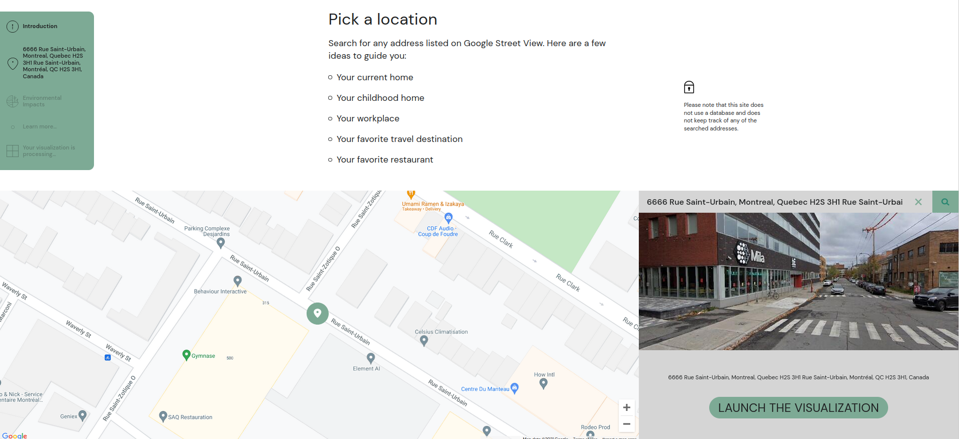 --- count: false ## Our goal ### A website to encourage climate change awareness and action .center[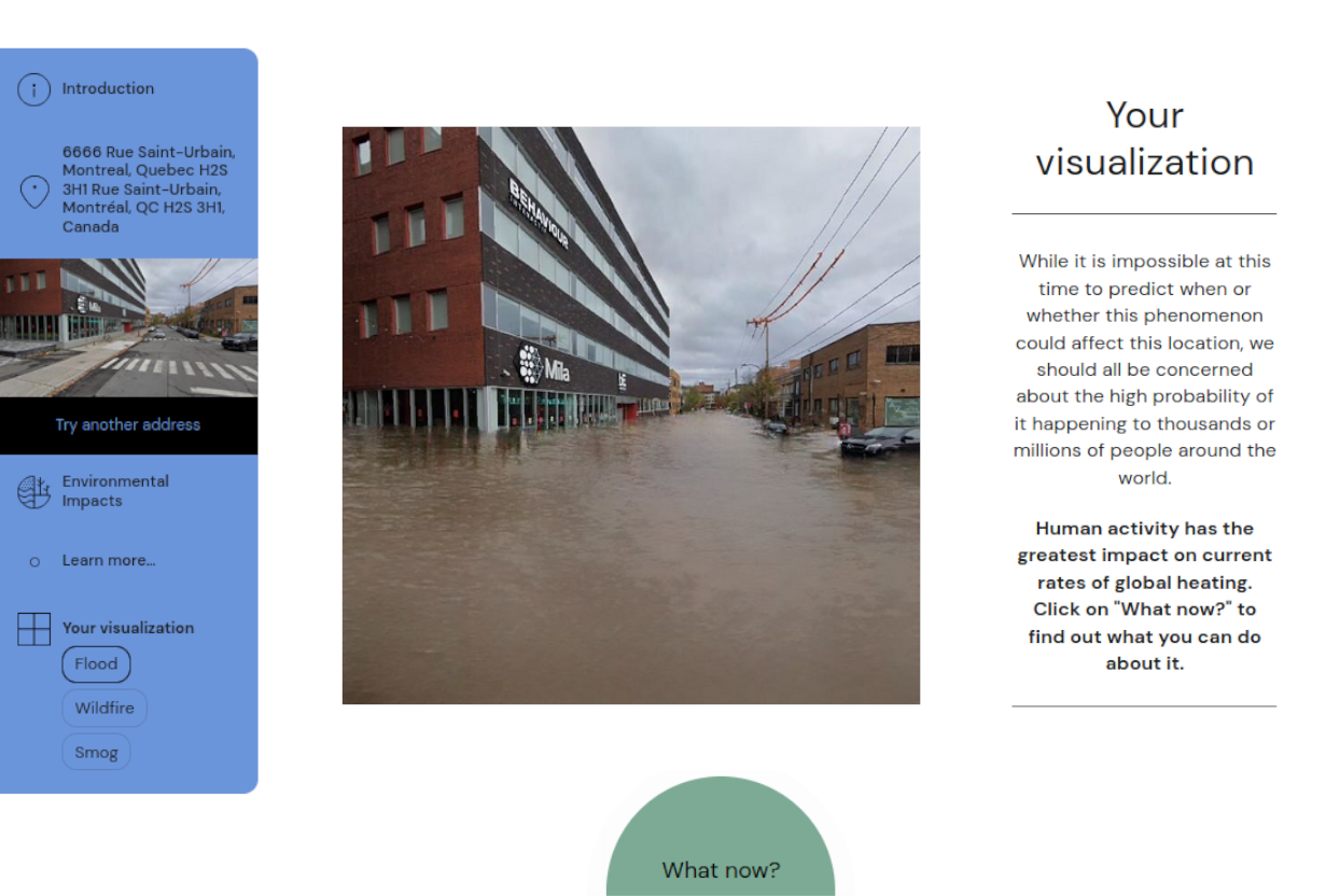] --- count: false ## Our goal ### A website to encourage climate change awareness and action .center[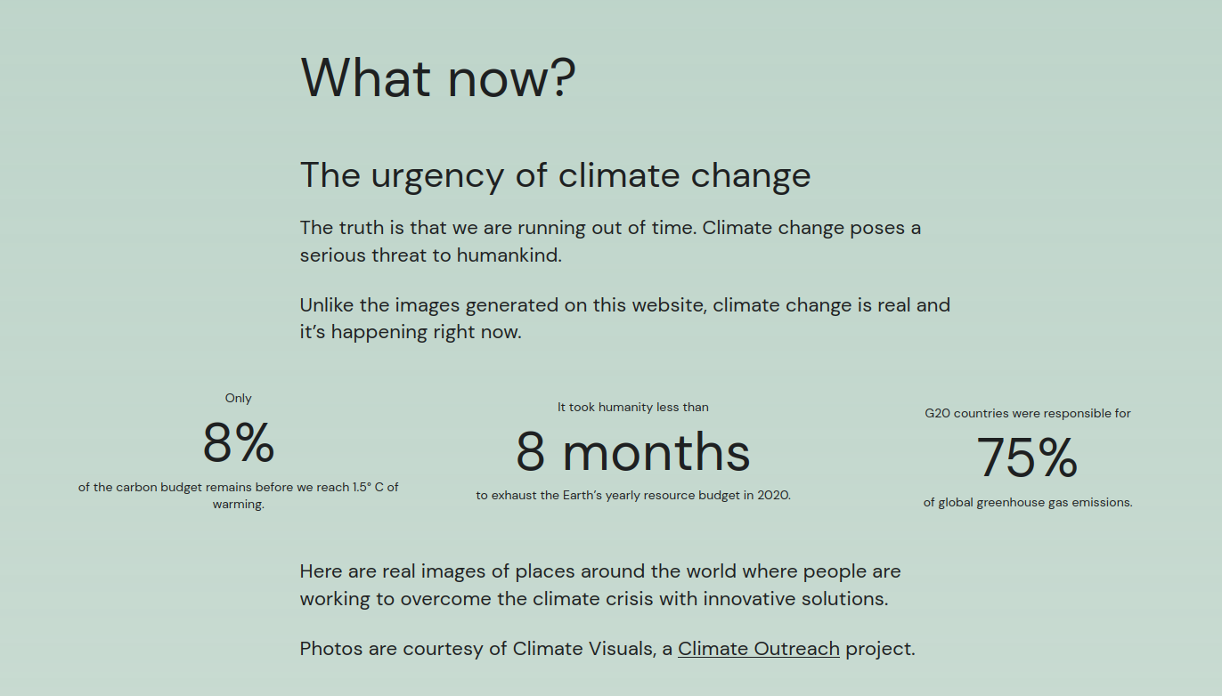] --- count: false ## Let's try it out! .center[ .bigger[.bigger[[ThisClimateDoesNotExist.com](https://thisclimatedoesnotexist.com)]] .bigger[.bigger[[CeClimatNExistePas.com](https://ceclimatnexistepas.com)]] ] ??? https://thisclimatedoesnotexist.com/en/share/56d8058c-23d5-4083-b1b4-4afe6a5b2fe9 --- ## Why floods, wildfire, smog? .context[Our algorithm and the website simulates floods, wildfires and smog on input images.] -- <br> .columns-3-left[ * Flash floods kill **5,000** people per year. * Sea levels are expected to rise by **2 metres** by the end of the century * Rising sea levels could disrupt the lives of **1 billion people** by the end of 2050. ] -- .columns-3-center[ * As much as **40% of the Amazon** forest is at risk of becoming a savanna. * In 2015, forest fires claimed roughly **980 000 $km^2$** of the world’s forest. * Forest fires were responsible for **1.8 gigatonnes of carbon emissions** in 2019. ] -- .columns-3-right[ * Outdoor air pollution is believed to be responsible for **4.2 million** premature deaths per year. * Air pollution is responsible for **6% of deaths** worldwide. * According to the WHO, **91% of the world's population** lives in places where air pollution levels exceed the safety limits. ] -- .full-width[ .conclusion[Floods, wildires and smog are some of the worst environmental hazards for humanity, and we can communicate their impacts visually.] ] --- ## Methods ### Floods simulation with _ClimateGAN_ .context[The algorithm had to be able to generate realistic floods on any photo from Google Street View.] -- .left-column[ Key challenges: * Visual perception is sensitive to unrealistic scenes: * Water texture (reflections, luminosity, etc.) * Geometry of the scene (edges, obstacles, etc.) * Physics (slope, view point, etc.) * The algorithm was meant to be deployed _in the wild_ and should work with highly variant range of photos. * We had to overcome the lack of training data: there is no data set of photos of _before and after_ the flood. ] .right-column[ 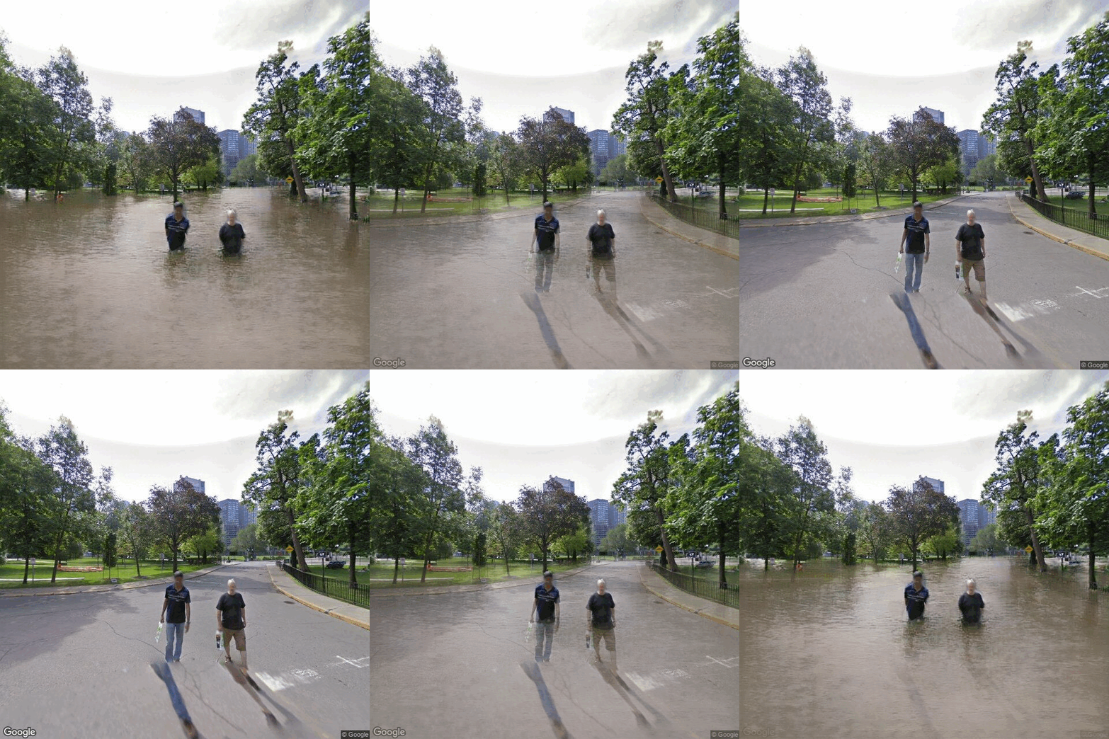 ] --- ## Methods ### Floods simulation with _ClimateGAN_ .context[Simulating photo-realistic floods is challenging because visual perception is very sensitive to unrealistic scenes and the lack of data.] -- .left-column[ Key features: * Data from a simulated virtual word to overcome the lack of training data * Domain adaptation to bridge the gap between simulated and real photos * Two-stage flood generation: _Masker_ + _Painter_ * Combination of _depth_ and _semantic segmentation_ to improve water mask predictions * Conditional image generation to _paint_ realistic water on the predicted mask ] .right-column[ 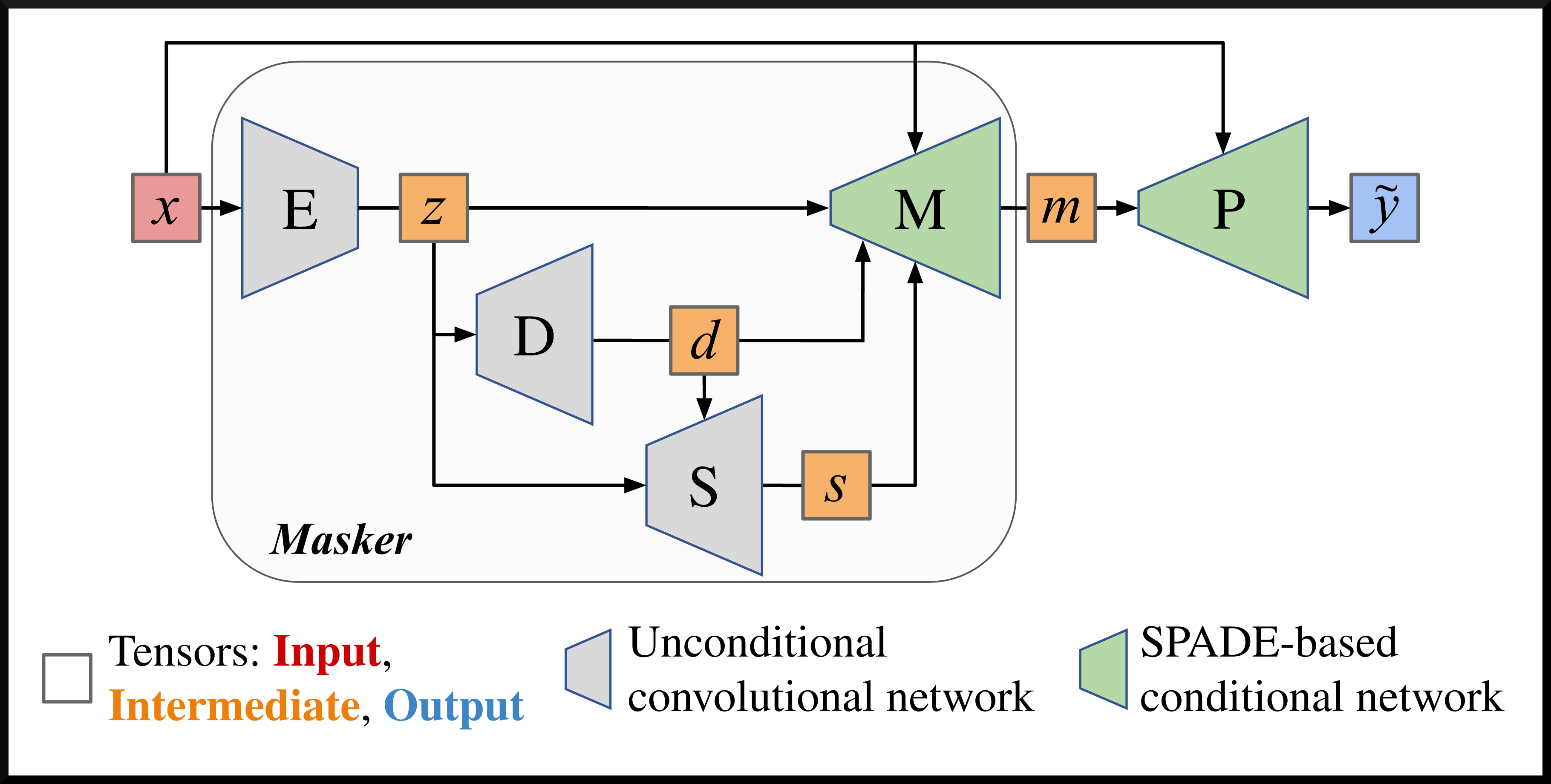 ] --- ## ClimateGAN ### Simulated data .context[We collected 1,200 photos of real floods and 5,500+ _non-flooded_ scenes to train our model. However, _real_ photos lack geometry and segmentation labels.] We simulated a $1.5~km^2$ virtual world with Unity3D and generated 20,000 images that mimic Google Street View. .center[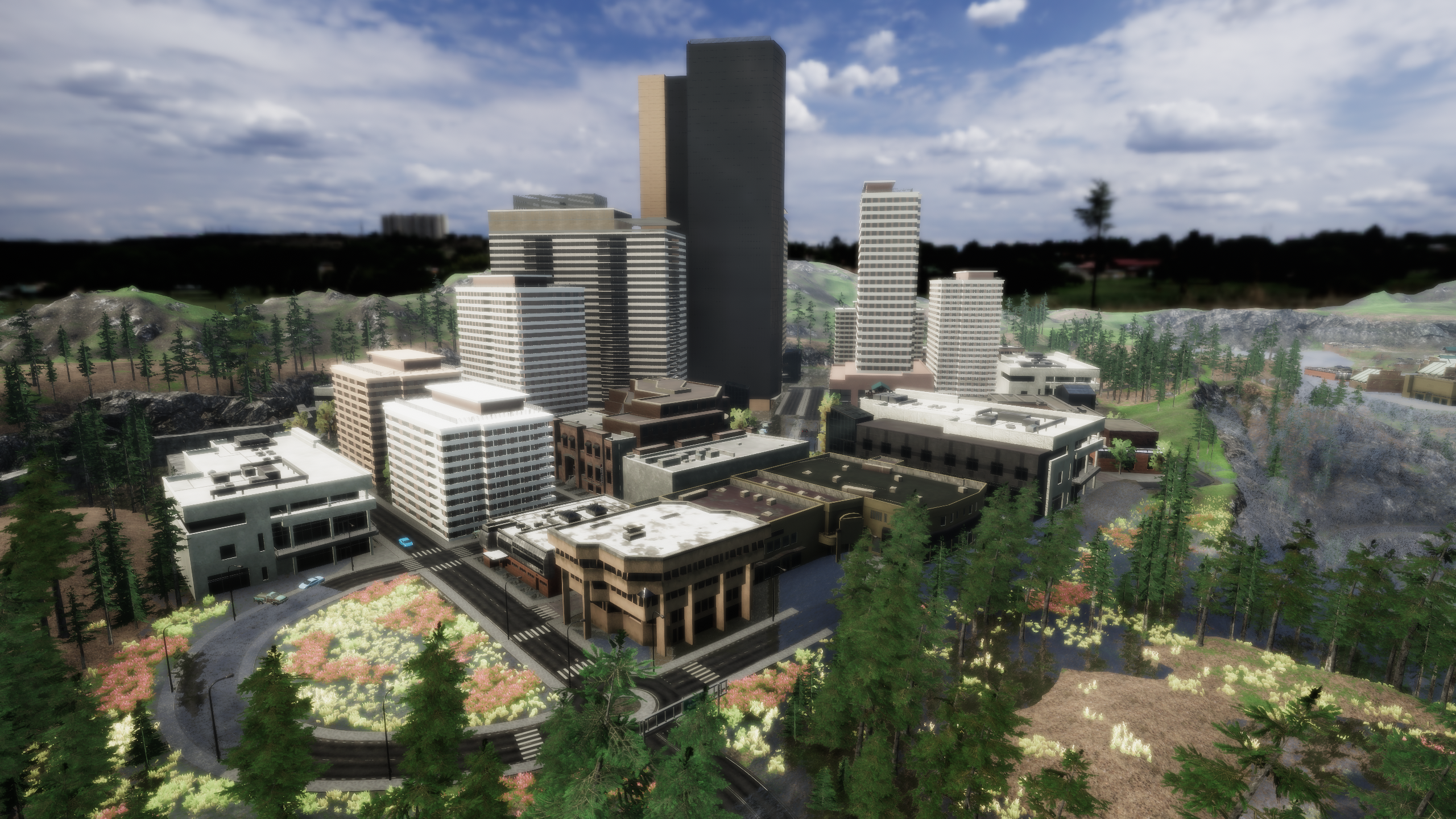] --- count: false ## ClimateGAN ### Simulated data .context[We collected 1,200 photos of real floods and 5,500+ _non-flooded_ scenes to train our model. However, _real_ photos lack geometry and segmentation labels.] We simulated a $1.5~km^2$ virtual world with Unity3D and generated 20,000 images that mimic Google Street View. .center[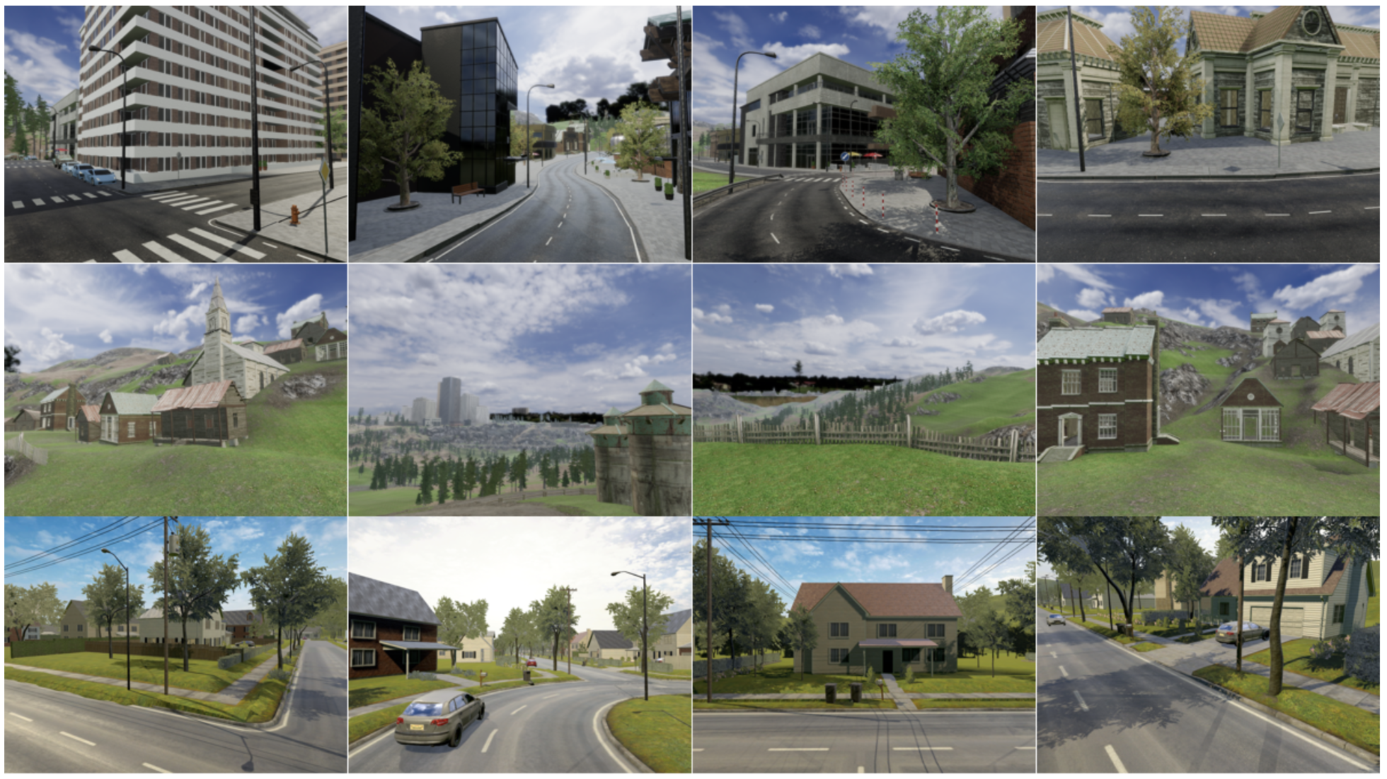] --- ## ClimateGAN ### Masker .left-column[ * Trained with _real_ and _simulated_ images * Domain adaptation with ADVENT * Depth decoder * Segmentation decoder * Mask decoder conditioned on depth and segmentation using SPADE * All decoders trained simultaneously (multi-task learning) ] .right-column[  ] --- counter: false ## ClimateGAN ### Masker .left-column[ * Trained with _real_ and _simulated_ images * Domain adaptation with ADVENT * Depth decoder * Segmentation decoder * Mask decoder conditioned on depth and segmentation using SPADE * All decoders trained simultaneously (multi-task learning) ] .right-column[ 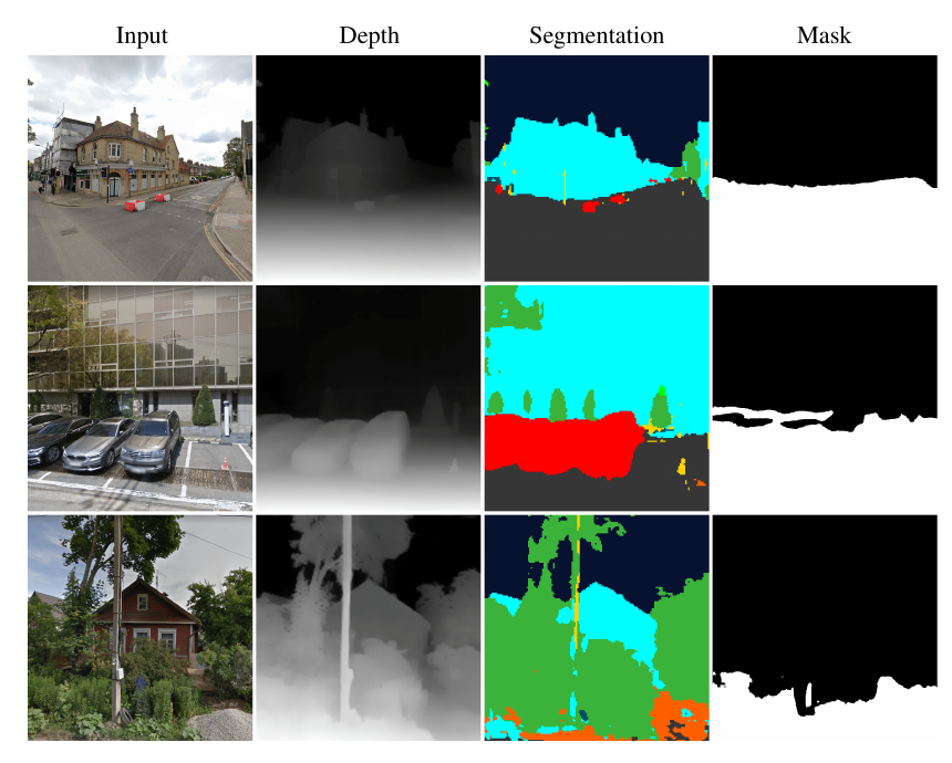 ] .conclusion[The masker receives an input image and outputs a binary mask of the water location, making intermediate predictions of depth and semantic segmentation.] --- ## ClimateGAN ### Painter .left-column[ * Trained with 1,200 real images of floods * The painter has to generate flooding water conditioned on the context of the image: sky, buildings, etc. * Conditional image generation with GauGAN * Conditioned on the Masked image * SPADE blocks ] .right-column[  ] --- counter: false ## ClimateGAN ### Painter .left-column[ * Trained with 1,200 real images of floods * The painter has to generate flooding water conditioned on the context of the image: sky, buildings, etc. * Conditional image generation with GauGAN * Conditioned on the Masked image * SPADE blocks ] .right-column[ 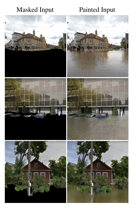 ] .conclusion[The painter receives an input image and a mask prediction and outputs an image of a flood that we combine with the masked input.] --- ## ClimateGAN ### Masker + Painter .center[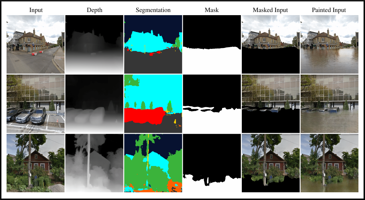] --- ## ClimateGAN ### Comparison with other methods .center[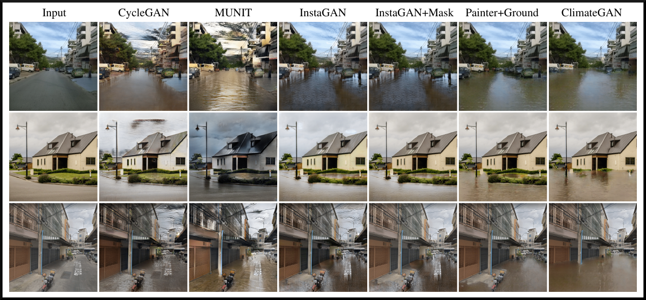] --- ## ClimateGAN ### Human evaluation .context[We asked human participants to assess the visual quality of the output images, compared to alternative algorithms.] _Which image looks more like an actual flood?_ .center[] .conclusion[The images from our algorithm were consistently judged as more realistic than those from other methods.] --- ## ClimateGAN ### Ablation study .context[We systematically evaluated the contribution of several components of the algorithm.] * We annotated the pixels a set of _test_ images as _must be flooded_, _cannot be flooded_ or _may be flooded_. * We proposed 3 metrics to best evaluate the quality of the water masks: error, F05 score and _edge coherence_. .center[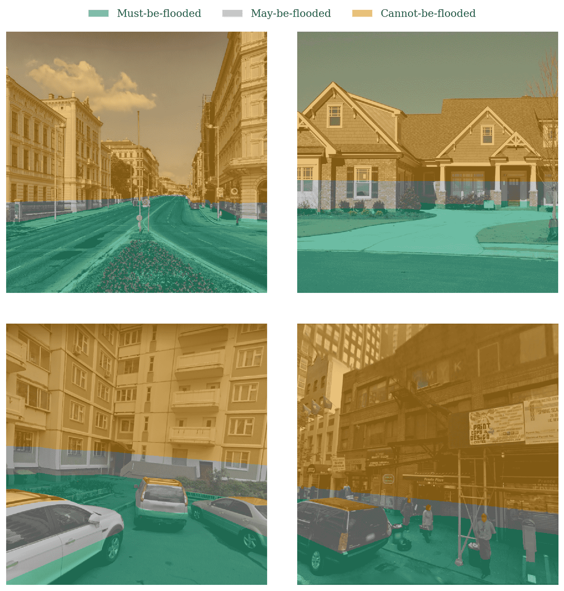] --- count: false ## ClimateGAN ### Ablation study .context[We systematically evaluated the contribution of several components of the algorithm.] * We analysed each component according to the three proposed metrics. .center[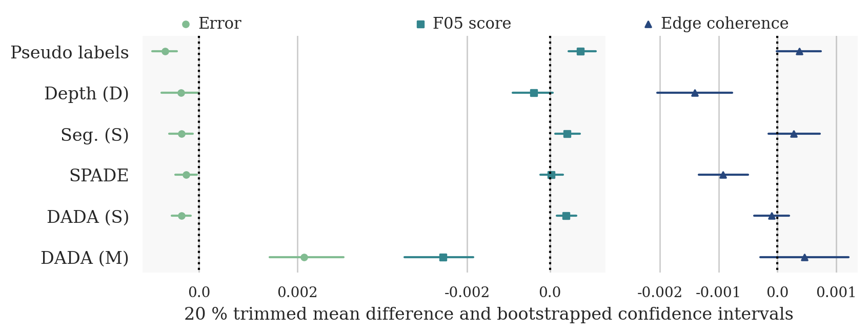] .conclusion[6 of the 5 proposed components for the architecture proved to positively contribute to the performance.] --- ## Future directions and limitations * [_ThisClimateDoesNotExist.com_](https://thisclimatedoesnotexist.com) is not an exerise of climate prediction. There is no correlation between the consequence chosen and the address entered. Our algorithm applies a systematic transformation regardless of the address. * While this is in part a limitation, this allows us to simulate the impacts of climate change, at any location, regardless of the specific risk. * Still, it would be interesting to integrate climate prediction and modelling into our simulations, for other applications. -- * Our algorithm systematically simulates the same level of water (about 1 metre). It would be interesting to allow for more flexible simulations. * An interesting application would be to make the simulations reflect the impacts of various climate actions. -- * We are currently working with Prof. Erick Lachapelle and Thomas Bergeron on a study of the effect of personalised imagery in climate communication. --- ## To know more * Visit the website: [ThisClimateDoesNotExist.com](https://thisclimatedoesnotexist.com) .center[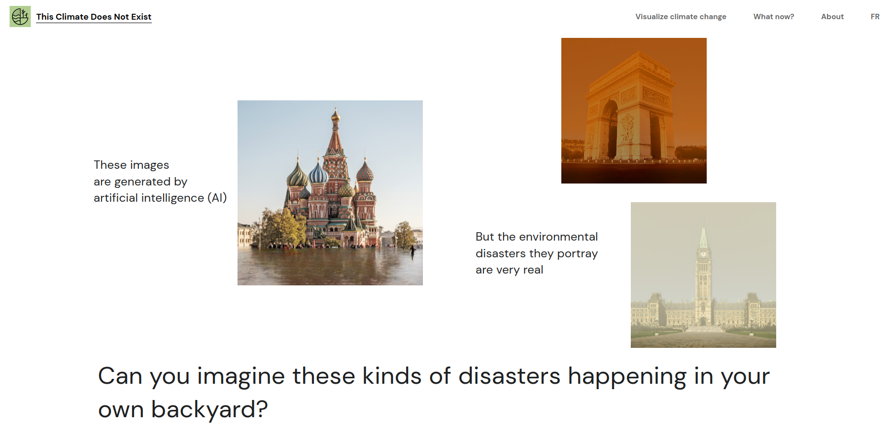] * Check out our preprint: [ClimateGAN: Raising Climate Change Awareness by Generating Images of Floods](https://arxiv.org/abs/2110.02871v1) .center[] --- name: title class: title, middle ## Thank you! .bigger[Alex Hernández-García (he/il/él)] Victor Schmidt, Sasha Luccioni, Yoshua Bengio et al. .turquoise[GIS Day, McGill University · Montréal · Nov. 17th 2021] .center[ <a href="https://mila.quebec/"><img src="../assets/images/slides/logos/mila-beige.png" alt="Mila" style="height: 6em"></a> ] .footer[[alexhernandezgarcia.github.io](https://alexhernandezgarcia.github.io/) | [alex.hernandez-garcia@mila.quebec](mailto:alex.hernandez-garcia@mila.quebec) | [@alexhdezgcia](https://twitter.com/alexhdezgcia)] [](https://twitter.com/alexhdezgcia) --- name: title class: title, middle count: false .center[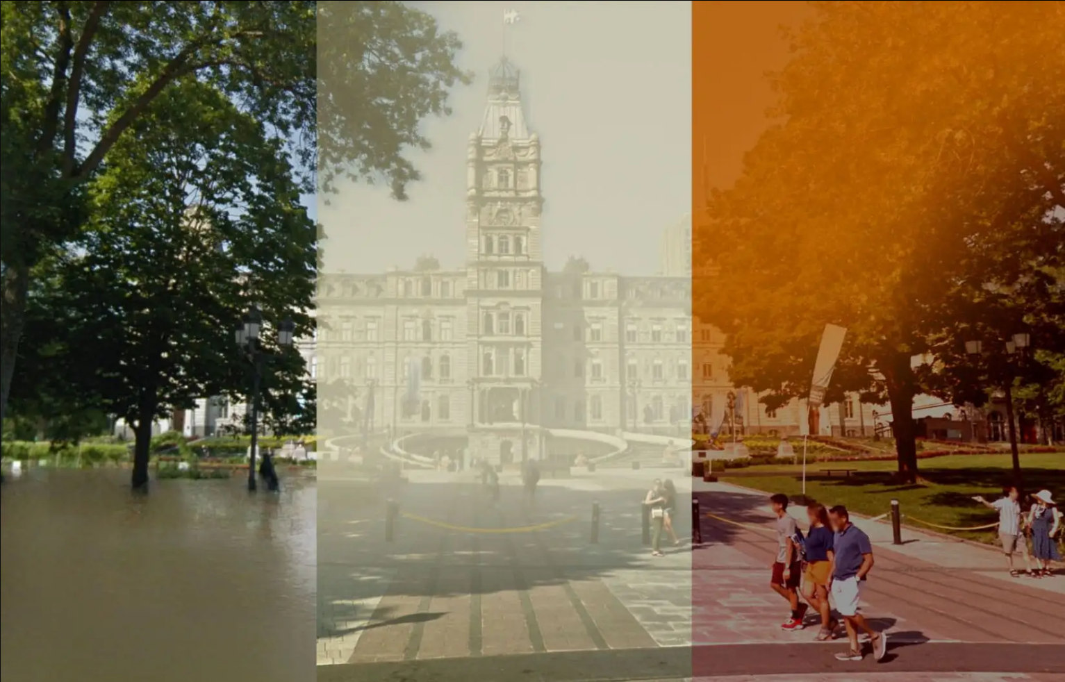] .center[ <a href="https://mila.quebec/"><img src="../assets/images/slides/logos/mila-beige.png" alt="Mila" style="height: 6em"></a> ] .footer[[alexhernandezgarcia.github.io](https://alexhernandezgarcia.github.io/) | [alex.hernandez-garcia@mila.quebec](mailto:alex.hernandez-garcia@mila.quebec) | [@alexhdezgcia](https://twitter.com/alexhdezgcia)] [](https://twitter.com/alexhdezgcia)